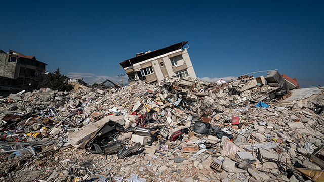
Earthquake models

Moody’s RMS™ earthquake models are crafted from a rich blend of historical insights, the latest in earthquake science, detailed geological conditions, and global engineering knowledge. Designed to deliver deep insights into earthquake risks, our models account for a wide range of effects including tsunamis and fires following earthquakes. Beyond primary threats, our models adeptly capture the complexities of the secondary geohazards such as liquefaction and landslides, allowing for a thorough understanding of both widespread and localized earthquake risks.

At the core of our offerings, the HD modeling framework helps firms understand earthquake risk by using high-resolution simulations to generate realistic event timelines and losses, capturing hazards’ temporal and spatial development. This approach not only tracks the evolution of hazards over time and space but also provides comprehensive loss estimates to seamlessly integrate with one's financial considerations.


What we do

01 Comprehensive hazard representation

Comprehensive hazard representation

Moody's RMS earthquake models incorporate a wide range of seismic hazards focused on the key drivers of seismic risk for each geography. These include ground shaking, liquefaction, and earthquake-induced landslides, as well as fire following an earthquake, earthquake sprinkler leakage, and tsunamis (where applicable) to provide a robust representation of earthquake risk.

02 High-resolution risk assessment

High-resolution risk assessment

Advanced methodologies, such as spectral response-based damage estimation and variable resolution grids, allow for high-resolution risk assessment and loss quantification, helping users make detailed analyses at both the individual location and portfolio level.


High-definition (HD) modeling

The HD modeling framework helps firms provide an understanding of earthquake risk by using high-resolution simulations to generate realistic event timelines and losses, capturing hazards’ temporal and spatial evolution. This approach provides detailed, ground-up loss estimates that flow through financial contracts, enhancing accuracy in risk assessment and decision-making.


Sub-peril modeling

Our earthquake models incorporate the effects of sub-perils such as tsunamis and fires following earthquakes, and, where relevant, provide an individual impact assessment. The models also account for complex secondary geohazards like liquefaction and earthquake-induced landslides to accurately represent their potential to cause both extensive and highly localized losses.

03 Strategic partnerships

Strategic partnerships

The development of our earthquake models involves collaboration with local experts, scientific agencies, and local insurance markets. This helps make sure the models are based on the latest scientific research and local building practices, thereby enhancing their accuracy and reliability.

04 Local and market expertise

Local and market expertise

Our earthquake models use localized data, such as geotechnical data layers and region-specific ground motions, to provide accurate hazard estimates. Benefit from country-specific expertise with models built in close collaboration with on-the-ground scientific agencies, local engineers, and research bodies.


Case studies

case study
Creating a more resilient earthquake insurance marketplace in California

The California Earthquake Authority (CEA) is one of the world’s largest providers of residential earthquake insurance representing over 1 million policyholders and with a claims-paying ability of about $19 billion.


“The Moody’s loss analysis for the CEA/PEER project provided important information about the reduction of earthquake damage to houses that have a code-compliant crawlspace retrofit.
This information is currently being included in our mitigation outreach to provide homeowners with an understanding of the physical and financial protection provided by seismic retrofitting.
The analysis results make our mitigation outreach efforts more meaningful to California homeowners.”

Janiele Maffei, Chief Mitigation Officer, CEA


Where we help

Regional and country earthquake models


01 North America Earthquake Models

North America Earthquake Models

Moody’s RMS North America Earthquake Models provide a holistic view of earthquake risk across the United States, Canada, and Mexico. Incorporating the latest seismic hazard data from the US Geological Survey, the Geological Survey of Canada, and the latest scientific information about seismic sources in Mexico, the models include advanced features such as probabilistic liquefaction and landslide models, basin models including below Los Angeles and Mexico City, a comprehensive fire-following earthquake model, and the ability to model induced seismicity in the US Midwest.

02 South America, Central America, and Caribbean Earthquake Models

South America, Central America, and Caribbean Earthquake Models

Moody’s RMS South America, Central America, and Caribbean Earthquake Models provide a comprehensive solution for assessing earthquake risk across 46 countries, islands, and territories. With a comprehensive update in 2022 for Central and South America and in 2024 for the Caribbean, these models incorporate the latest scientific research and methodologies — including updates to ground motion models, geotechnical data, and vulnerability functions — to accurately estimate the impact of ground shaking, liquefaction, landslides, and tsunamis.

03 Europe Earthquake Models

Europe Earthquake Models

Moody’s RMS Europe Earthquake Models help users evaluate earthquake risk across 21 countries, including the particularly high seismic hazard regions of Italy, Turkey, and Greece.

The models incorporate advanced methodologies such as spectral response-based ground motion modeling and damage assessment, and they support a wide range of applications from policy pricing and primary underwriting to managing exposure aggregations and understanding tail risk. The models also include features like post-event loss amplification to capture economic demand surge and claims inflation.

04 Asia-Pacific Earthquake Models

Asia-Pacific Earthquake Models

We offer a comprehensive earthquake model suite of 14 models with coverage across the Asia-Pacific region, including Japan, New Zealand, China, India, Taiwan, Indonesia, and the Philippines.

These models incorporate the latest scientific research and high-resolution geotechnical data to accurately model soil amplification, earthquake-induced landslides, and liquefaction, along with country-specific vulnerability functions developed with local engineering expertise. With a consistent framework for modeling loss across a range of scales, from location to portfolio and within a city or across country borders, firms can apply rigorous analysis to regional earthquake risk analysis.

05 Japan HD Earthquake Model

HD Earthquake Model

The Moody's RMS HD Earthquake Models offer a detailed and advanced assessment of earthquake risk, integrating the latest scientific research and data from significant events. The models include comprehensive modeling of ground shaking, liquefaction, and earthquake-induced landslides, as well as tsunami inundation and fire following an earthquake where applicable, providing a robust and holistic view of potential earthquake impacts.


News and views

whitepaper
Quantifying the impact of home retrofit in California

The California Earthquake Authority’s project, coordinated by PEER, set out to enhance the seismic resilience of wood-frame houses and reduce earthquake losses through effective retrofitting measures. Read our whitepaper to learn how the CEA achieved its retrofitting goals.

blog
The foreshock modeling challenge

The Japanese Meteorological Agency’s recent advisory highlights the increased risk of a megathrust earthquake following a significant foreshock, emphasizing the need for enhanced earthquake preparedness in Japan.

blog
Latest risk insights for Central and South American earthquakes

The updated Version 22 RMS® Central and South America Earthquake Models provide the most up-to-date view of earthquake risk in 15 countries, which have a combined population of approximately 450 million people.

blog
Twenty-five years of building resilience in Taiwan: Looking back at the 1999 Chi-Chi earthquake

With a magnitude of 7.6, the Chi-Chi earthquake remains Taiwan's most damaging earthquake of the 20th century. Twenty-five years later, our blog revisits the catastrophe and Taiwan's efforts to rebuild resilience.

blog
How did the 1999 Izmit earthquake shape earthquake risk in Turkey?

Twenty-five years later, we revisit the 7.4 magnitude earthquake that struck İzmit, Turkey, causing extensive damage and resulting in over 18,000 fatalities.


GET IN TOUCH

Speak to our team

Interested in learning more about our offerings? Our solutions specialists are ready to help.